Queue Eye
Better Traffic Management!
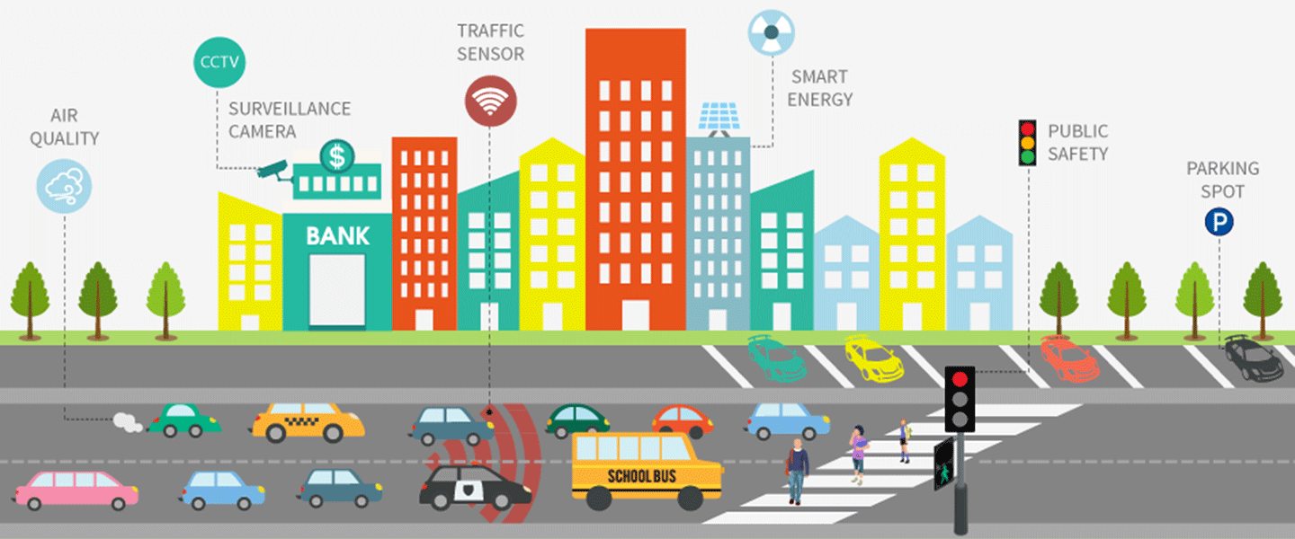
Artificial Intelligence based Traffic Monitoring and Forecast Across the Globe.
Helping highway authorities, state administrations and smart cities to manage road traffic and build future infrastructure planning efficiently.
Powered by:
Bulleye Technologies LLP, Noida
Email: bulleyetech@gmail.com
Remote Mapping
No hardware (cam/sensors), internet, power or human intervention required at the desired monitoring spots.
Adaptive & Dynamic Modeling
Using historical traffic pattern and comparing with real-time data, system becomes smarter to understand and predict.
External Influencing Factors
Considers external influencing factors (weather, weekends, festivals) on regular traffic to measure their impact.
Automated Alert System
Automated system study the traffic data pattern and escalate the issue to concerned authority whenever required.
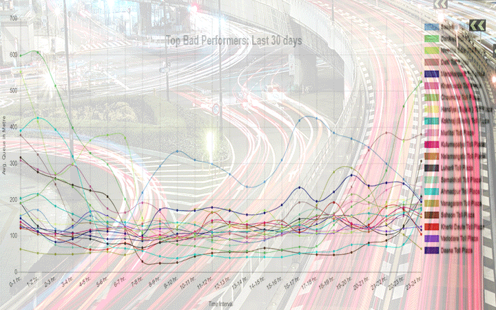
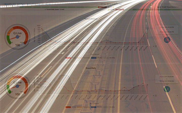
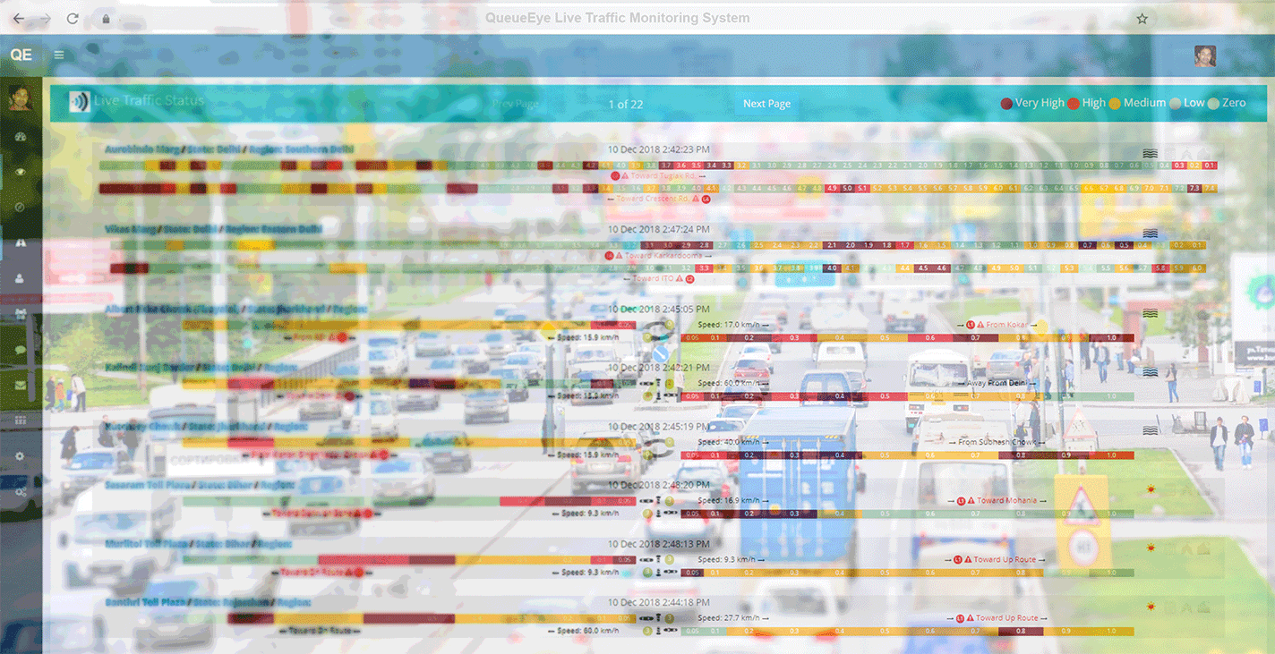
Smart Traffic Monitoring Dashboard
Queue Eye is a SaaS-based platform in the area of the intelligent transportation system (ITS). Its helps state administration, highways authorities, municipal corporation to manage traffic at different choke points.
Implementation in Govt. and Corporate Sectors
Queue Eye is equipped with satellite imagery, various Remote Sensing and GIS Technologies. It is becoming a vital tool for making smart decisions in corporate and Government bodies.
About Queue Eye
Growing traffic volume in metros, major cities, highways & smart cities is a major concern nowadays. On one side volume of vehicles are increasing day-by-day & further side with limited or no horizontal landscape expansion for new roads has become a big concern world around.
It results to waste commuters time, increase fuel consumption & lead awful environmental impact. Which leads government authorities to seriously discover the possibility of utilizing better ITS system.
The solution has pending patents, which uses several cutting-edge technologies like Satellite Imagery, GIS Remote Sensing Algorithm, Pattern Recognition Algorithms (Artificial Intelligence), Big-Data & Data Science related tools.
How Queue Eye Works
We at Queue Eye, brings a novel approach which helps a smarter way to manage traffic, organized traffic flow, leverage existing road inventory for better throughput.
Queue Eye
Throughput Utilization
System maps the existing road inventory and keep predicting better ways to utilize the maximum throughput.
Queue Eye
Extensive Dashboard
Detail-oriented dashboard gives whole key information with almost real-time graphical visualizations.
Queue Eye
Detailed Reporting
Daily, weekly & monthly reports are helpful for future course of action for govt. authorities and corporate.
Queue Eye
No Capex Required
This is a Cloud-based hosted platform with web technology on front end. It needs no up front investment.